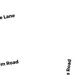
17 POTASH HILL LN
Owner Information
DECESARE VINCENT M
17 POTASH HILL LN
HAMPDEN, MA 01036


Property Details
17 POTASH HILL LN is classified as a Single Family Residential (Colonial).
The primary structure on this property was built in 1972. There are 6,022ft2 of built area within this property. There is 3,040ft2 of residential/living space within this property. This property is listed as having 11 rooms.
17 POTASH HILL LN is valued at $403,500. The land is valued at $84,100 and the structures are valued at $315,800. There is an additional valuation of $3,600 on this property.
This property is in Zone R4. Confirm with local Zoning Board authorities to ensure there are no overlays or other easements on this property.
The most recent deed for 17 POTASH HILL LN is recorded at the local registrar in Book LC 32963, Page 0. 17 POTASH HILL LN was last sold on Friday, September 22, 2006 for $1.
Assessment data from fiscal year 2022.
Flood Data
According to the FEMA National Flood Hazard Layer, this property does not appear to be in a flood zone. It may also be in an area not yet reviewed. Nonetheless, confirm this information prior to taking any action.
To view the flood hazards around this property, create a FEMA "Firmette" Map of the area around 17 POTASH HILL LN.
Broadband Internet Providers
| Provider | Type | Bandwidth (mbps) | |
|---|---|---|---|
| Crown Castle Fiber | Fiber | 0 | 0 |
| Viasat Inc | Satellite | 100 | 3 |
| Verizon New England Inc. | DSL | 5 | 0 |
| Charter Communications Inc | Cable | 940 | 35 |
| T-Mobile | Fixed Wireless | 25 | 3 |
| GCI Communication Corp. | Satellite | 0 | 0 |
| HughesNet | Satellite | 25 | 3 |
| VSAT Systems, LLC. | Satellite | 2 | 1 |
Broadband service provider data from December 2020.
Adjacent Properties
- 212 SOMERS RD
Single Family Residential owned by LABELLE ROBIN D - 218 SOMERS RD
Single Family Residential owned by NELSON RICHARD - POTASH HILL LN
Undevelopable Residential Land owned by SMITH DEON - 25 POTASH HILL LN
Single Family Residential owned by SMITH DEON - 11 POTASH HILL LN
Single Family Residential owned by BURZDAK STEVE A